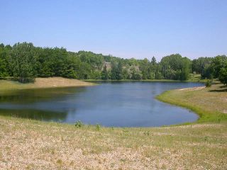
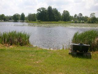
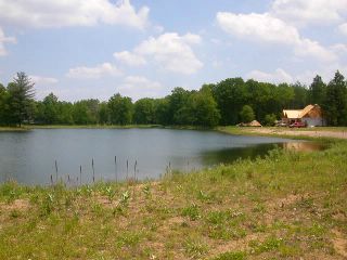
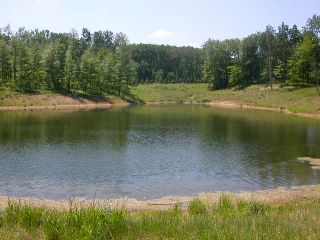
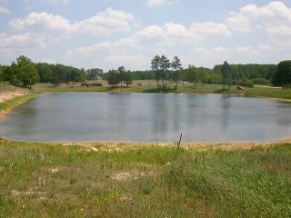
Tuesday, January 24, 2006

CLPOC Smaller Lakes Profiles

The following are limnological assessment reports on the smaller aquatic systems under the management responsibility of the Canadian Lakes Development. A table of the analytical data for each system can be found below. The table data depicts the ability of aquatic vegetation to keep water clear. At the time of the early June sampling event, available nutrients (phosphorus) in the water column had not yet been taken up by aquatic vegetation or macro algae. By the late July sampling event, available nutrients were significantly lower in all the lakes sampled. Total phosphorus levels were down to the point that algal blooms could be avoided without the use of algaecides. Many of these lakes have a very limited native aquatic vascular plant population. In some of these lakes it was the algae taking up the phosphorus. This demonstrates the need for native aquatic plants and their ability to insure high water clarity by reducing the potential for algal growth.


Small Lakes Data Table from 2005 CLAM Program Report


The South end of Lost Canyon looking North.

Lost Canyon Lake

Lost Canyon Lake
Location: Off Cheyenne Wells Trail near the North Entrance Gate
Size: 6.7 Acres (GPS)
Inlet/Outlet: None
Developed Shoreline: No
Max Depth: ~10 ft
Mean Depth: ~6ft
Aquatic Vegetation/Macro Algae: Chara dominated with lily pads in shallow areas. Small patches of sparse Illinois Pondweed mainly in the southern half of the lake with a small bed of Sago Pondweed at the north end associated with cattails.
Fish Population: Hybrid bluegills and sunfish (green) dominant. Sunfish were spawning on shallow sandy bar at time of assessment. Notable yellow perch observed. Largemouth bass present with very few larger fish observed
Plankton Community: 7-20-2005
(No herbicide treatment applied in 2005)
Zooplankton: Rotifers, Copepods and Cladocera very common and diverse reflecting balanced system
Phytoplankton: Very diverse, only semblance of dominance by small thin filamentous Ocillatoria-like. Ceratium present. Sample very low in blue-greens with no “cyctins”
Sample very mixed with ample smaller green algae
Notes: Lost Canyon Lake is a great example of a natural system with no shoreline development and natural buffer zones surrounding the lake. Water clarity remained high throughout the 2005 summer season despite massive nutrient inputs from aspen “snow”. Released nutrients were taken up by non-nuisance native plants before algae could gain momentum. One of the true hidden jewels of the Canadian Lakes development and one of the most undisturbed aquatic systems.
Recommendations: Shallow water is limiting the fish population due to overwinter stress and lack of biodiversity potential. Having no observed minnow species is also limiting fishery production. This system would be an ideal canidate for an experimental Golden Shiner/Fathead minnow stocking. It may also be an ideal system to introduce non-nuisance native aquatic plant species to demonstrate stabilizing effects of native biodiversity. Maintenance crew should leave a buffered area along the East shoreline, it is being mowed down to the water’s edge currently in conjunction with mowing of the park and tennis court on that side of the lake.

Camper Pond North and Camper Pond South
Location: In the Campground near the NE and SW corners of Camper Lake
Size: ~1 acre each (No GPS Map)
Inlet/Outlet: None
Developed Shoreline: None on the South Pond but trailers on South West and North shore of North Pond
Max Depth: <10 ft
Mean Depth: <6ft
Aquatic Vegetation/Macro Algae: Chara dominated, lily pads near shore and in the shallows, with Utricularia or Bladderwort being the dominant aquatic vascular plant.
Fish Population: Unobserved
Plankton Data: 7-20-2005


A view from the East side of North Camper Pond.


Looking Southeast across South Camper Pond

Camper Pond North and South

Camper Pond North and Camper Pond South
Location: In the Campground near the NE and SW corners of Camper Lake
Size: ~1 acre each (No GPS Map)
Inlet/Outlet: None
Developed Shoreline: None on the South Pond but trailers on South West and North shore of North Pond
Max Depth: <10 ft
Mean Depth: <6ft
Aquatic Vegetation/Macro Algae: Chara dominated, lily pads near shore and in the shallows, with Utricularia or Bladderwort being the dominant aquatic vascular plant.
Fish Population: Unobserved
Plankton Data: 7-20-2005
North Camper Pond:
No CLPOC herbicide treatment in 2005, Possible Aquashade treatment by residents
Zooplankton: Rotifers & Copepods common and diverse, Cladocerans very rare (near shore sample) Sample high in organic detritus
Phytoplankton: Dominated by filamentous Ulothrix, Lngbya, Oscillatoria and non-filamentous blue-green Gomphosphaeria
Sample very mixed, Ankistrodesmus, and some smaller green algae
Notes: The North Pond is experiencing nutrient inputs from erosion. Improve buffers and stabilize shoreline. Appears Aquashade was applied to the pond, possibly by nearby resident. Purple loosestrife was observed and pulled along the East (road) side of the pond. Would benefit greatly from improved buffer strips.
The South Pond is more ecologically stable and undeveloped. Supporting a fairly diverse native vegetation population and maintaining fair water clarity. Ponds could be stocked with minnow species. These ponds would benefit from an adopt a pond program by campground residents. Planting of native vegetation, forage species and removal of debris.
Recommendations: Use as experimental minnow planting systems, community programs and “adopt-a-pond” type projects.


Camper Lake at the East shore looking West

Camper Lake

Camper Lake
Location: Center of the Campground
Size: ~18 acres (No GPS Map)
Inlet/Outlet: None
Developed Shoreline: Trailers surround the majority of the waterbody but do so at a considerable distance from the shoreline. Water quality is being most impacted at the high bank at the North end where serious erosion has occurred.
Max Depth: ~8 ft
Mean Depth: <5ft
Aquatic Vegetation/ Macro Algae: Prior to the start of development in the early 60’s Camper Lake was a small bog. The bulldozers created a shallow “doughnut” leaving part of the original bog as an island in the center. This bog heritage is witnessed by the rich diversity of native plant species. A relatively natural diverse and balanced system for the development. No species is dominant per say, but large Chara beds were being forced to the surface by trapped fermentation gases in the sediment beneath. Once brought to the surface, they die and look like drowned camels. Chara and near shore lily pads are the most abundant, with Illinois and Sago Pondweed, Northern milfoil and Utricularia or Bladderwort all common and at non-nuisance levels.
Fish Population: Surprisingly diverse. A healthy sunfish/bluegill population, a limited bass and perch population and the occasional northern pike were observed. Most notable was the minnow population with several species of minnows observed in abundance. Some of these fish were likely introduced from fisher peoples unwanted bait buckets while others like the Bridle shiner are possible relics from the pre-existing bog.
Plankton Data: 7-20-05
No herbicide treatment in 2005:
Zooplankton: Copepods common, Rotofers present, Cladocerans very rare (near shore sample) Sample high in organic detritus and mixed protozans etc (bog)
Phytoplankton: Dominated by Ceratium, filamentous Oscillatoria-like, and Dinobryon. Non-filamentous blue-green Gomphosphaeria common.
Notes: The North end of the Camper Lake “doughnut” is experiencing severe erosion. The erosion of the high bank from development over has filled in the dozer dug trench and is restricting boat passage. Summit Laboratory received multiple member complaints on this site. In addition to restricting boat passage, the filled area is supporting dense aquatic vegetation being a shallow, sun exposed and fertile area.
Recommendations: Use as experimental systems, community programs and projects
Focus attention to the north end. Stabilize the bank, and improve boat passage. No fish stocking is recommended as the system is highly productive with the most established forage base of an aquatic resource in the CL development. Minnows could possibly be taken from Camper Lake for experimental stockings of the Camper Ponds. Interest has been expressed in a boardwalk or improved access to the Lake. Monitor for dead Chara, algal issues and exotics.


The West side of Kitt Lake looking East at the Southern portion of the lake.

Kitt Lake

Kitt Lake
Location: In the Waterford of Tullymore SE of the intersection of Abbey Lane and Dunhill Drive
Size: ~4 Acres (No GPS Map)
Inlet/Outlet: None
Developed Shoreline: Recent and current development of 4 established homes and a fifth nearing completion at the time of the survey.
Max Depth: ~11 ft
Mean Depth: ~6ft
Aquatic Vegetation/Macro Algae: Chara dominated with an occasional patch of
Sago, Illinois, Floating Leaf, Broad Leaf and Illinois Pondweeds; Slender Naiad and Bladderwort creating a stable diversity of native plant species. No species is dominant per say with nuisance issues only occurring in isolated deeper beds and a shallow area along the east side of the lake.
Fish Population: What is most unique about Kitt Lake is that it has no large predator (fish- pike, bass, perch or crappie). A low spawning success hybrid sunfish population was established via stocking and a very limited minnow population exists. The lake presents an ideal opportunity to stock Golden Shiners and Fathead to see how well they survive and reproduce. After the forage base is established, predator fish can be added to create a solid fishery.
Plankton Data: 7-20-2005
No herbicide treatment in 2005
Zooplankton: Rotifers and Copepods common, Cladocerans present but rare (near shore sample)
Phytoplankton: Good diversity, Ceratium, Micrasterias, filamentous Spirogyra common, non-filamentous blue-green Gomphosphaeria present
Sample very mixed good smaller green algae
Notes: Kitt Lake has a very active Lake Association whose members have high expectations for their lake. With low-density development, an active lake association, and low in-lake nutrient concentrations, Kitt Lake has the potential to provide high water quality for years to come if vigilance continues.
Recommendations: Some spot aquatic plant treatments may be required, but nutrient management and the committed lake association should allow us to minimize nuisance issues just by tweaking the natives currently in the lake. Forage base stocking and eventual bass, perch, and/or crappie stocking should take place. We plan to visit regularly to monitor aquatic plant and fish population and to work with riparians to minimize nutrient inputs. Native vegetation can be managed to insure season long high water quality.


A view from the North end of Lily Pond looking South

Lily Pond

Lily Pond
Location: Just north of Buchanan and West of Timberlane
Size: ~2 Acres (No GPS Map)
Inlet/Outlet: Inlet pump with no outlet
Developed Shoreline: Some development on the West side with preexisting houses to the NE. High bank is unstable and erosion is a major threat
Max Depth: ~10 ft
Mean Depth: ~6ft
Aquatic Vegetation/Macro Algae: Being among the youngest of the CLPOC lakes, Lily Pond is one of the least diverse systems in the development. The pond bottom is colonized by Chara; with no other aquatic vegetation being observed. This leaves the pond extremely susceptible to algal blooms as there is no native vegetation to take up nutrient inputs from erosion and terrestrial debris inputs.
Fish Population: The Lily fish population is highly artificial, unstable, and biologically inappropriate from a recent pre-CLAM stocking. The stocking of Hybrid sunfish, Largemouth Bass, and Channel Catfish will make it next to impossible to establish a forage base of minnows. A small school of minnows was observed on the day of assessment. It is likely these forage fish will be exhausted by bass predation after young of year bass and bluegills have all been consumed. Prey has no cover and low quality food. Spawning beds were common but no young of the year fish were observed due to extreme predation and cannibalism.
Plankton Data: 7-20-2005
No herbicide treatment in 2005
The Inlet Pump was running at time of sampling
Zooplankton: Rotifers, Copepods (dominant) and Cladocerans present
Phytoplankton: Dominated by small filamentous Ulothrix-like, some Spirogyra.
Asterionella most common plankton smaller green algae rare, sample not very diverse
Notes: On the day of the assessment, numerous geese were on the pond. Abundant painted turtle and various frogs also observed. Algal blooms will continue to be an issue having no real native vegetation to take up released nutrients. The inlet pump is low in nutrients and should help to maintain water quality.
Recommendations: Establish non-nuisance native plant population. No fish stocking until present population stabilizes and aquatic plants take. Focus attention on the high banks erosion to get them stabilized as soon as possible.


West side of Rush Lake looking East

Rush Lake

Rush Lake
Location: Summer Hill, just north of Buchanan and just East of 125th
Size: 4 Acres (GPS)
Inlet/Outlet: Inlet pump with no outlet
Developed Shoreline: Homes currently being built around the shoreline. Houses are up off the water but steep banks are a major erosion threat.
Max Depth: 9.7 ft
Mean Depth: 6ft+ (See bathymetry map)
Aquatic Vegetation/Macro Algae: Constructed at the same time as Lily Pond and therefore demonstrating a similar and expected lack of diversity. Chara is blanketing ~2/3 of the bottom substrate. A small bed of Illinois Pondweed exists at the NW corner of the lake and a very small stand of Sago Pondweed has rooted near the pump inlet at the SE corner. Large clouds of filamentous algae were utilizing most of the available nutrients.
Fish Population: No fish of any species were observed during the assessment. A dense leech population was observed during a mid summer sampling event.
Plankton Data: 7-20-2005
No herbicide treatment in 2005
Zooplankton: Rotifers, Copepods and Cladocerans present at low numbers
Phytoplankton: Low diversity sample, dominated by thick Asterionella bloom, some Microcyctis
Very few green algae
Notes: Again, erosion is a major concern. With a low nutrient inlet pump and currently manageable nutrient levels, high water clarity and quality could be maintained simply by stabilizing the bank and establishing non-nuisance natives.
Recommendations: Use as demonstration lake/experimental system. Stabilize the banks and establish native plants. Aggressive minnow stocking is recommended. Could be used as a brood stock pond until native plants take and the forage base is ready to sustain predators.

Golden Pond

Golden Pond (No Photo Available)
Location: On the 17th fairway of the Royal South, NW of the corner of Sunset Lane and Sunset Drive
Size: ~2 Acres (No GPS Map)
Inlet/Outlet: From Sunset Lake to Little Muskegon River
Developed Shoreline: Homes along the South Shore, Golf Course on the North
Max Depth: 7 ft+
Mean Depth: ~5ft
Aquatic Vegetation/Macro Algae: Chara dominated with very few IP beds. Some filamentous as summer progressed
Fish Population: The size of the water body limits the population structure of Golden Pond. Fish population not assessed directly but managed under the assumption that Golden Pond hosts the same species as Sunset Lake with size based restrictions on population potential.
Plankton Data: Not Available
Notes: Golden Pond is the most downstream significant water body of the Lake Laura chain. With recent improvements in the “upstream” golf course fertilization program, Golden Pond will be managed to require very few herbicide/algaecide inputs. High water quality and clarity can be achieved by limiting inputs (The No Spray zone at west end of Sunset Lake will help to act as a biofilter). Golden Pond is being monitored for filamentous and nuisance level native plants.
Recommendations: Monitor nutrient levels, native plants, and watch for filamentous in heat of summer as riparians do use the pond for swimming. Stock Golden Shiners/Fatheads.